Dilijan – The historical Gazakh territory covered a wide area, which included present-day Gazakh, Aghstafa, Tovuz, partially Gadabay regions of Azerbaijan, as well as parts of Armenia – Karavansaray (now Icevan), Barana (now Noyemberyan), Shamseddin (now Berd), Garagoyunlu (now Krasnoselsk), Dilijan, and the Borchali region of Georgia.
The northwestern region of Azerbaijan has a longstanding history of human habitation dating back to ancient times. The picturesque Dilijan valley, which has served as a historic crossroads for caravan routes, lies within the territory of Karvansaray district. In recent years, Dilijan district, with Dilijan city at its center, was established in this valley. Throughout the centuries, the people from Gazakh, Aghstafa, Shamkir, and Tovuz regions have found solace in the tranquility of the Dilijan valley during the summer months. Notably, the renowned Azerbaijani writer and playwright, Najaf Bey Vazirov, also worked as a forester in this captivating area. It is even known that Gachag Karam (Fugitive Karam) and his team sought refuge in the forests of Dilijan.
The Dilijan valley, a name frequently encountered in various historical and literary texts, was once a city within the Gazakh uezd of the Ganja governorate. Subsequently, this territory was annexed to the current Republic of Armenia. M. Seyidov’s linguistic analysis proposed that the word “jan” (life) phonetically evolved from the word “gan” (blood), carrying the meaning of “father” or “ruling figure”. According to the author, Dilijan, as a complex ethnotoponym (Delijan, Delejan), signifies the “residence of an esteemed and renowned leader” from the “Tele” tribe.
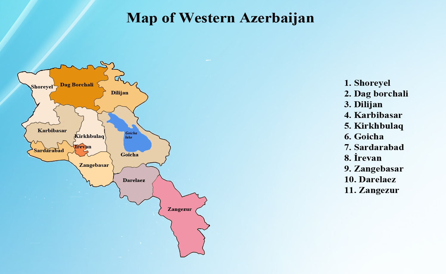
During 1924-1930, a total of 80 toponyms were changed in Armenia. Historical documents reveal that although various reasons were cited for changing Turkic toponyms in Armenia, the primary motive was to distance them from their Turkic origins. This period witnessed a significant intensification of Lenin’s pro-Armenian policy and the Armenianization of Azerbaijani toponyms. With Lenin’s approval, Armenians successfully solidified their territorial claims in 1920. As part of the effort to establish the Republic of Armenia, territories including Zangazur, Goycha districts, and the Dilijan valley in the Gazakh uezd, which were inhabited by Azerbaijanis, were formally transferred from Azerbaijani sovereignty and placed under Armenian jurisdiction. When the Russian Empire reorganized the administrative divisions of Azerbaijan, the borders of Western Azerbaijan underwent a significant alteration. Western Azerbaijan was subdivided into several uezds, including Dilijan, Etchmiadzin, Zangazur, Iravan, Yeni Beyazit (Kavar), Loru-Pambak, Sharur-Daralayaz, and Shoregal-Gumru (Alexandropol).
Until 1826, Dilijan was one of the villages within the Gazakh district. Up until 1919, it was officially designated as the Gazakh-Dilijan uezd within Azerbaijan. During the early 1920s, significant administrative reforms resulted in the dissolution of this district and the establishment of a new one. Subsequently, the name of Dilijan underwent a transformation to “Krasnoyeselo.” It’s noteworthy that prior to the advent of Soviet rule in Armenia, Dilijan was an integral part of the Gazakh Uezd within the Ganja Governorate.
It’s important to note that the Dilijan region once encompassed 21 Azerbaijani and 8 Armenian villages. In 1951, a decree led to the consolidation of Dilijan district with Ijevan district, Azizbeyov district with Mikoyan district, Alayaz district with Abaran district, Garabakhlar district with Vedi district, and Gukasyan district with Amasiya. Moreover, personnel reallocations were implemented, involving the removal of Azerbaijani personnel, subsequently leading to the redivision of some of these regions.
A portion of the Garagoyunlu district, predominantly inhabited by Azerbaijanis, is situated in this region. The remaining section of the Garagoyunlu district lies within the Krasnoselsk district (now Chambarak district) of the Goycha region.
Following 1995, Armenians renamed the region to Tavush, attempting to distort its historical identity. The true name of this area is Tavus, derived from the Tavus Castle located within its borders. This fortress was constructed by the Huns who settled in the region during the 3rd century AD. Its name translates from ancient Turkic language as “fortress on the mountain,” represented as “Tau ust gala” (Tukustak-Taukustka-Tauustkala) in ancient Turkic langauge. In the local dialect, the fortress is referred to as Tauusgala (Touusgala) by the indigenous population. Until 1965, official documents recognized it as Tavus. Subsequently, it was erroneously renamed Tovuz due to the influence of the Azerbaijani word “Tovuz,” which translates to “peacock.” It is worth noting that the influence of Armenians in this matter was significant. Thus, Armenian sources refer to the area as Tuzkatak (Тузкатак/Тучкатка), where the second part of this word, “katak,” is interpreted to mean “bird”.