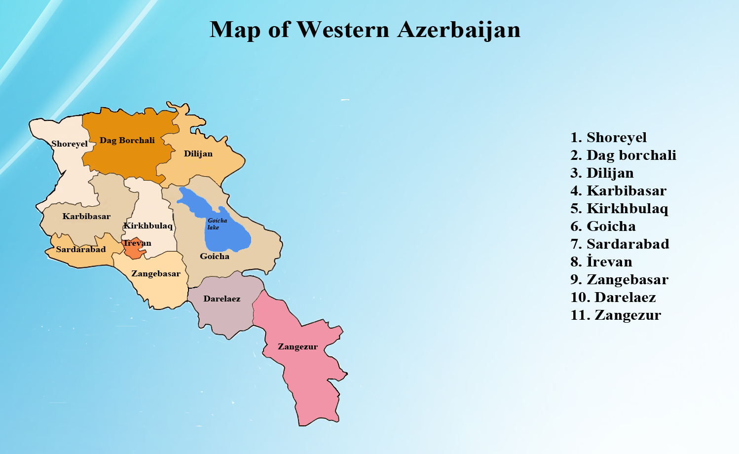
Daralayaz district – Daralayaz district, situated in the mountainous region of Sharur-Daralayaz historical province within Western Azerbaijan, is our ancestral homeland. It is enclosed by imposing natural features: the Basarkechar plateau to the north, the Zangazur range to the east, the Alayaz Mountains to the south, and the Salim mountain pass to the west. This region, spanning 2304 square kilometers, has been inhabited by Azerbaijanis since time immemorial. In ancient times, the toponym Daralayaz-Alayaz valley referred to an administrative-territorial division encompassing a vast expanse. In the early 18th century, Daralayaz was among the 14 districts comprising the Nakhchivan Sanjak, administered by the Ottoman Empire. This district boasted a total of 102 villages during that era. As per the local population’s perspective, the territory was demarcated into three regions: East Daralayaz, West Daralayaz, and the mountainous region of Sharur.
The term “Daralayaz” was derived from the Turkish ethnonym “alagoz,” combined with the Azerbaijani word “dara,” signifying “a depression between two mountains or hills.” When the country underwent administrative restructuring, Nakhchivan province was divided into five districts, with Daralayaz district among them. Subsequently, this district was consolidated with Sharur district and incorporated into the Iravan governorate, bearing the name Sharur-Daralayaz uezd. During the era of the Iravan Khanate (1827-1840), Sharur district was a part of this Khanate, while Daralayaz was under the jurisdiction of the Nakhchivan Khanate. After Tsarist Russia occupied the Khanates of Nakhchivan and Iravan, they established an “Armenian Province” in the region. However, during the administrative-territorial reorganization of 1840, the “Armenian Province” was dissolved, and the uezds of Iravan and Nakhchivan were created. In 1870, a new uezd, Sharur-Daralayaz, was established, encompassing the territories of Sharur and Daralayaz.
Following the signing of the Treaty of Turkmenchay between Russia and Iran in 1828, the region witnessed a substantial demographic transformation as a consequence of the extensive resettlement of Armenians to our historical homeland, Western Azerbaijan, and the Daralayaz district. Prior to this resettlement, Azerbaijani families comprised 94.1 percent of the region’s population, while Armenians represented only 5.8 percent. However, post-resettlement, the proportion of Armenian families increased significantly to 25.8 percent. Between 1828 and 1830, a total of 2,773 Armenians were relocated from Iran and Türkiye to Daralayaz.
Based on the 1897 data, the Daralayaz region encompassed an area of 2972.3 square kilometers and was inhabited by a population of 76,551 individuals. According to this information, Azerbaijanis constituted 70.5 percent of the population, while Armenians made up 27.5 percent. Tragically, during the period of 1918-1920, the Azerbaijani population of Daralayaz faced a harrowing genocide, resulting in the displacement of survivors from their native lands. In response to the threat posed by the terrorist Andronik Ozanyan, the Fourth Caucasian Army of Ottoman Türkiye entered the borders of Azerbaijan with the aim of protecting the Muslim-Turkish population. A platoon of soldiers and officers, led by Musa Garabakir Pasha, also visited the Daralayaz district during this period.
The map of the Sharur-Daralayaz uezd was compiled using the information provided in the “Caucasian calendar” (Кавка́зский календа́рь) of 1902. Tragically, during the period of 1918-1920, the Azerbaijani population of Daralayaz faced a harrowing genocide, resulting in the displacement of survivors from their native lands. In subsequent years, during the Soviet era, the Daralayaz region was transferred from Azerbaijani jurisdiction to Armenia without valid justification or legal basis. This transfer was part of a broader pattern of genocidal policies directed against Azerbaijanis throughout the 20th century, culminating in the forced displacement of our compatriots from Western Azerbaijan, including Daralayaz.
On August 10, 1920, the Caucasian Bureau of the Russian Communist Party (Bolsheviks) made a unilateral decision to cede the Sharur-Daralayaz region of Nakhchivan to Armenia, without the requisite approval from the leadership of the Azerbaijan SSR. Subsequently, in compliance with the resolution issued by the Central Executive Committee of Transcaucasia on February 18, 1929, the Sharur-Daralayaz uezd was officially dissolved, as part of the administrative division of the Azerbaijan SSR. This decision resulted in the transfer of this region, along with the villages of Gurdgulak, Khachik, and Horadiz, to Armenian jurisdiction. This action was in clear violation of the terms outlined in the Treaty of Moscow (1921) and the Treaty of Kars (1921), as well as established principles of international law. As part of the administrative division within the Armenian SSR, the Daralayaz district was subsequently divided into two separate districts: Keshishkend and Soylan districts. The Daralayaz mountain range (later renamed Ayotsdzor) is situated between the Arpa River and the Nakhchivan River, adjacent to the Zangazur peak in the east. Spanning a length of 70 kilometers, the highest peak within the range is Mount Kuku.
The forced expulsion and deportation of the population began in Daralayaz district, an ancient Turkish land, and the destruction and elimination of settlements continued in various stages until 1988. A total of 48 villages were deported once, 49 villages experienced two deportations, 16 villages faced deportation three times, 4 villages were expelled four times, and 1 village suffered deportation five times. Additionally, these villages were subjected to destruction and elimination. As our country’s president has affirmed, the day will come when our compatriots will return to our historical lands, where our ancestors resided for thousands of years, including Daralayaz district.